Andalucia
Grazalema and
Ronda
Sierra de Grazalema
South east of Seville and just to the north of
Gibraltar is the Sierra de Grazalema, forming
the western part of the Cordillera Betica
range before it drops down to the low lying
coastal lands on the Atlantic coast. There
are two significant protected areas in the
Sierra - the natural park named for the Sierra
de Grazalema and that of Los Alcornocales.
The mountains are not particularly high here
but there are craggy, almost perpendicular
peaks and deep gorges, caves and sink
holes. Because the area receives plentiful
rainfall the landscapes encompass fine
Mediterranean woodlands, including an area
of very rare pinsipar fir trees.
This is a rugged, relatively isolated area
which in the past provided refuge for some of
the more legendary bandits of southern
Spain. In nearby Ronda is a museum which
tells the stories of the bandits, many of whom
became folk heroes.
The main towns in the region are Zahara de la Sierra, Grazalema
and Cortes de la Frontera. They are linked by small, winding and
very picturesque roads. Walking routes penetrate into the
mountains and forests and link many of the towns and villages.
This is another area of pueblos blancos which gleam in the
sunlight and stand out for miles around.
There is excellent walking is between Zahara de la Sierra and
Grazalema. This is where the pinsipar forest is found but permits
are required for entry into the area and a degree of planning is
required. Other routes, further to the south around Cortes de la
Frontera, Montejaque and Benaojan have spectacular views and do
not require permits.
South of Cortes de la Frontera is Los Alcornocales Natural Park, a
small mountain range, which includes the largest cork oak forest
on the Iberian peninsula. It is criss crossed with walking tracks
and trails.
We spent four days in the area having made a base near Cortes de
la Frontera. We found a small hotel in the village of La Canada de la
Tesoro Real, situated on the railway line that runs from Algeciras to
Granada, passing through the spectacular town of Ronda.
Cortes de la Frontera is in a superb vantage point overlooking the sweeping Guadiaro valley
below, with a spectacular backdrop of the Serranía de Ronda mountains. Scattered around
the municipality are vestiges of the Roman and Moorish occupancy here, but since the late
17th century cork has contributed most to the local economy. Cortes used to be one of the
richest pueblos blancos because of cork production and evidence of this wealth can still be
seen today in the grand 18th-century mansions lining the main street.
It was a good choice as Grazalema, though beautiful, was living up to its reputation as the
wettest place in Spain and the walks in the area were shrouded in cloud. The requirement to
obtain permits for some of the walks was also an irritation.
Our first walk was from the nearby white village of Montejaque, a pueblo blanco that dates
from the time of the first Berber settlers. Its narrow winding streets lead into a dead end at a
central plaza, dominated by a parish church which was built on the original foundations of a
mosque. An ill-advised vehicle visiting here will find it almost impossible to turn around but
will entertain the elderly residents of the pueblo.
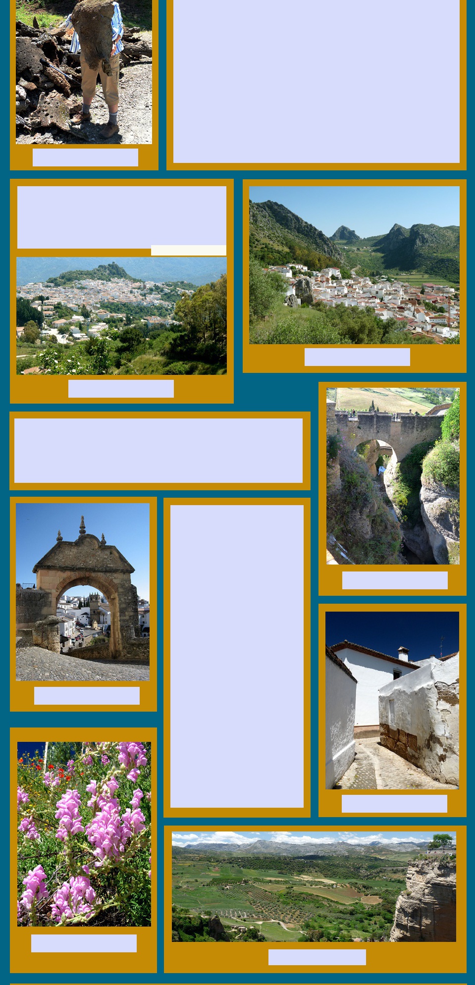
We parked well outside the village centre. After finding our way onto the GR7 we climbed on
a narrow road through dry limestone crags, passing several stone animal shelters built into
the hillside and known as cortijos. At the top of the climb was the reward of a view of the
Llanos de Libar, an extraordinary green fertile plain. The pastures were surrounded with
shady cork oaks and dotted with red poppies. The road wound along the plain, going past the
occasional farmhouse and the ruins of past habitations and always dominated by the rocky
peaks all about. It was magic.
After a while the track started climbing again and we lunched under a grove of cork trees,
interrupted only by some black Iberian pigs hurrying through the forest. We had intended to
make a loop back to Montejaque on a minor trail shown clearly on the map, but there was no
way marking to indicate where this might be so we returned the same way. It was a very hot
day so by the time we arrived back in Montejaque a cold beer in the plaza was very welcome.
On another day we drove south, down a steep rocky road through Los Alcornocales to El
Colmenar and on to Gaucín. You could spend several days walking the forest tracks of the
Alcornocales but we decided to do a round walk from the pueblo of Gaucin, a spectacularly
beautiful mountain village commanding sweeping views to Gibraltar and the Rif mountains of
North Africa.
The centre of the village is a tangle of narrow, twisting streets and a magnificent castle,
Castillo del Aguila dominates the village. Gaucín was once a haven for brandy and tobacco
smugglers who travelled through the surrounding hills. It is now a haven for the many British
expats who have moved to the region and for tourists escaping the nearby Costa del Sol.
The Gaucín walk was a circuit that climbed out of the town, around a ridge, then across
hillsides covered in gorse, cistus and cork trees to reach a cork cutters road which wound
down into a valley and looked across to the sierra that rises up behind our hotel. Piles of cut
cork were heaped up beside the road and all the trees were stripped of their bark up to their
first lateral branches. The hillsides in the valleys had been cleared for olive trees and timber
production with small farms dotted here and there. We descended a long way which meant it
was a long, hot climb back up to Gaucín where a cold beer had its usual restorative powers.
We have barely touched the walking possibilities around here. There
are many more short and long walks, of varying degrees of difficulty,
round Montejaque and the nearby village of Benaojan. Some of these
make a circuit of Hundidero, a spectacular perpendicular crag that
stands alongside the white elephant of a dam built during Franco's
time. It is never full because the construction engineers failed to
consider the porosity of the local limestone.
From our small village we also made a day trip to Ronda on the little local train rather than
bothering with trying to park in what is a very busy tourist Mecca. This railway line is
affectionately known as Mr Henderson's railway, named after a British military engineer, based
in Gibraltar who contrived of a way to take British personnel up into the cool of the hills during
the hot Spanish summers. It follows a pretty route through many tunnels along the Guadiaro
up to Ronda and on to Granada.
Ronda is spectacular, perched on a
fissure in the el Tajo gorge which is 100
m deep. Its old town dates back to
Moorish times and further developed after
the Reconquista. Three bridges straddle
the gorge, the most famous of which is
the much photographed Puente Nuevo.
The first, and lowest, is called the
Roman bridge although it was built in the
9th century by the Moors. In the middle
is The Puente Viejo, old bridge, also built
by the Moors, in 1616 was better. Finally
between 1751-1793 the Puente Nuevo
was constructed with four huge stone
arches over the lip of the gorge. All three
are still in use today but only the Puente
Nuevo carries vehicular traffic.
Ronda is a town of museums. Among
these there is a museum interpreting the
new bridge, a museum of the city, a
hunting museum, a bullfighting museum
and the bandolero's museum. Ronda
claims to be the home of bullfighting
where the art of modern bullfighting was
born and its 200 year old bullring is one
of the most revered in Spain. Banditry
was so prevalent in the area that the cult
of a Robin Hood like bandit was born. The
reality seems very different but the little
museum is full of memorabilia,
newspapers, costumes and story books
that attempt to tell a different story.
As with many other towns and cities in
Spain a strong association is made with
visitations by the romantic travellers of
the 19th century and Ernest Hemingway.
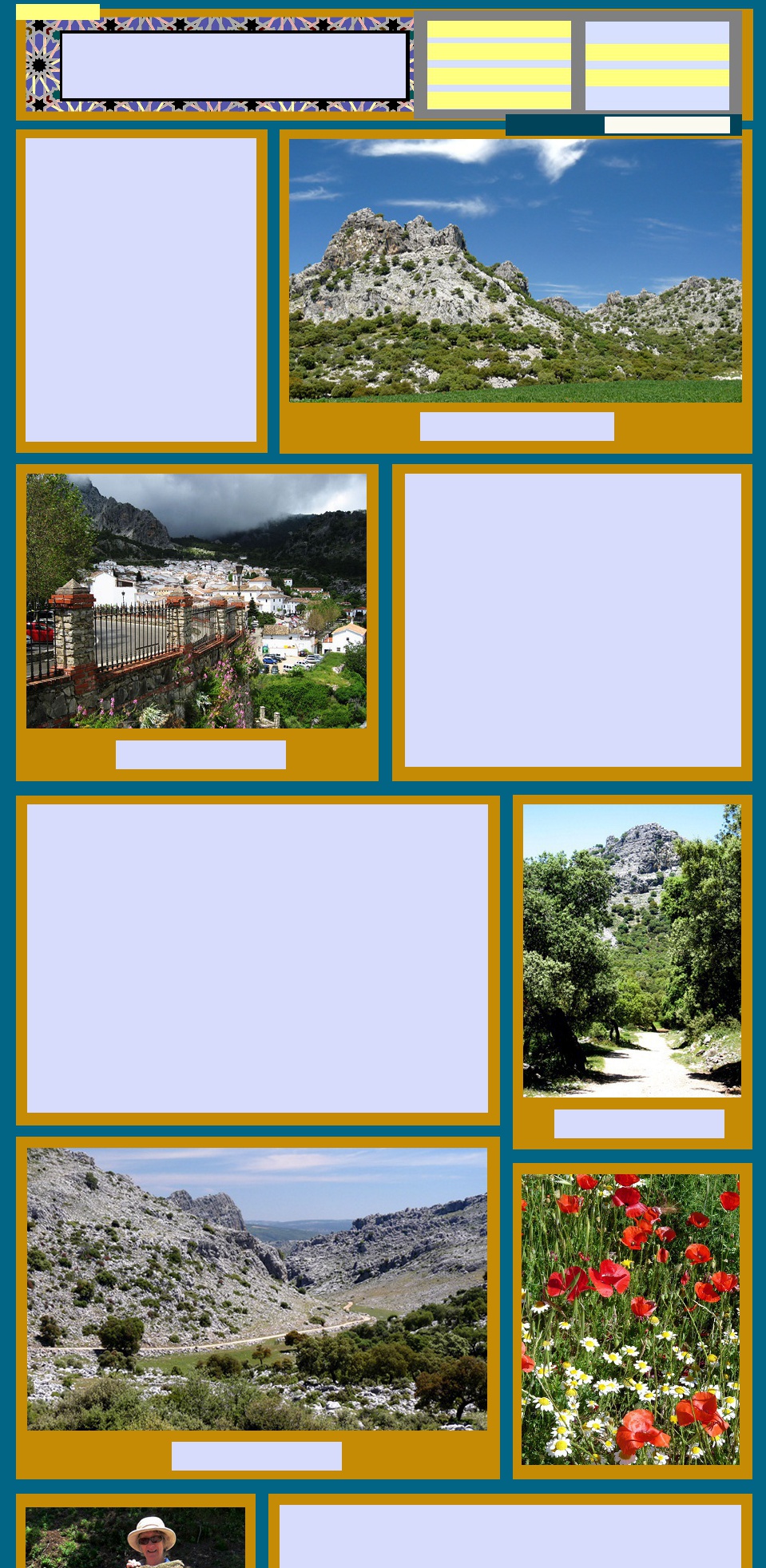
Limestone peaks, Llano de Libar
View of Grazalema
Through the Llano de Libar
In the Serrania de Ronda
A large piece of cork bark
View of Gaucín
View of Benaojan
The Old Bridges, Ronda
Gateway in Ronda
Alley way in Ronda
Wild snapdragons
View from Ronda
View pictures of
Go to Andalucia MENU